Iceland Travel Guides
Keilir: The Mountain That Helps Reykjanes Make Sense
A fuller private guide to Keilir, with its Ice Age volcanic form, old navigation role, symbolic place on Reykjanes, and why its silhouette means more than just a hike.
GlaciGo Iceland / May 2026 / 10 min read
Keilir is one of those Icelandic mountains that people often know before they know why they know it. The outline appears in the mind first: a solitary, sharply shaped mountain standing above the lower volcanic plain of Reykjanes, simple enough to draw from memory after seeing it once. Only later do many travelers realize how much cultural work that shape has been doing. Keilir is not only a hike, not only a geologic object, and not only a nice stop on the peninsula. It is one of Reykjanes' main orientation points, a mountain that has long functioned as a landmark in both practical and imaginative senses.
Visit Reykjanes says this directly and without exaggeration: Keilir is the most distinctive landmark of Reykjanes and a symbol of the peninsula. That sentence is the right foundation for the article. Many Icelandic mountains are beautiful. Fewer are instantly emblematic. Keilir belongs to the small group whose form becomes a shorthand for an entire region. If Snæfellsjökull can act as the mythic crown of Snæfellsnes and Kirkjufell as its visual celebrity, Keilir performs a different but equally important role on Reykjanes. It is the mountain that tells you where you are.
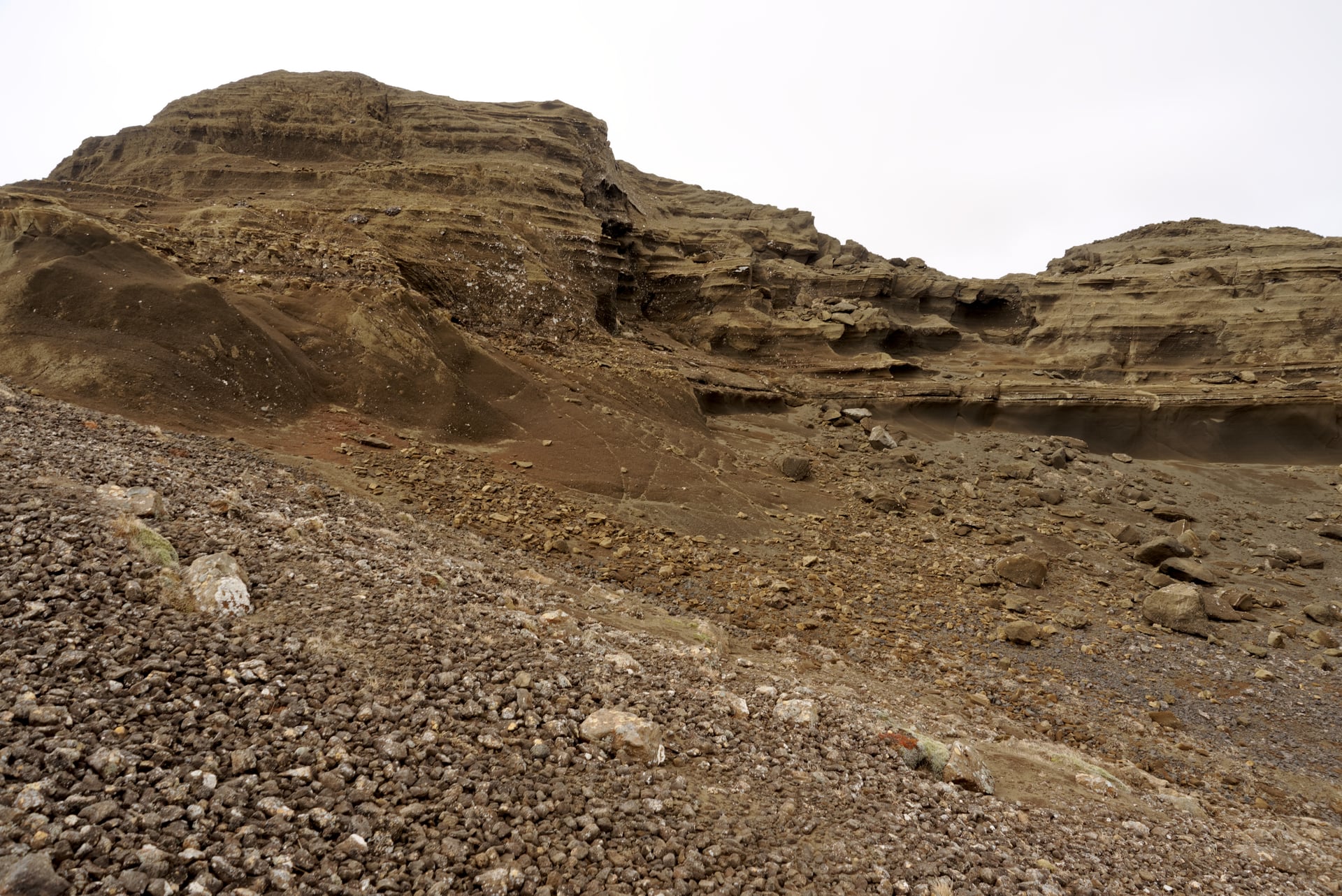
The same official source also explains what Keilir is geologically: a hyaloclastite mountain created during subglacial eruptions in the Ice Age. It adds that geologists consider it probably to be a crater plug. Reykjanes Geopark reinforces this with a closely related description, calling Keilir a cone-shaped hyaloclastite mountain attached to a low ridge and emphasizing its distinct shape and old role as a navigation mark. These details matter because they explain why the mountain feels so visually complete. Keilir is not just 'pointy.' It is a volcanic form whose shape makes it readable from a distance in a way few mountains manage.
That readability is one reason the mountain has such a strong presence in everyday Reykjanes geography. Long before the recent eruption years pushed the peninsula into global travel headlines, Keilir was already the thing many people in southwest Iceland could recognize from roads, viewpoints, and changing weather. A mountain that is easy to identify becomes part of regional mental furniture. People do not need to climb it to live with it. They orient by it, mention it, and unconsciously use it to structure the horizon.
This old navigation logic is especially important. Reykjanes Geopark explicitly describes Keilir as an old navigation mark. That phrase carries more weight than it first seems to. On a peninsula built from lava fields, low ridges, fissures, and broad wind-shaped expanses, a distinctive mountain matters not only as scenery but as directional intelligence. Keilir offered clarity where the wider volcanic landscape could otherwise feel laterally endless. Even now, in the age of maps and mobile navigation, the mountain keeps that older role alive at the level of perception.
The climbing side of Keilir should also be handled properly but not allowed to dominate the whole article. Visit Reykjanes notes that despite the mountain's steep slopes, it is not too difficult to climb, and that the summit view on a fine day is memorable. It also gives the practical landscape context: 4x4 vehicles can drive on Höskuldarvegur, there is parking by Oddafell, and from Höskuldarvellir the walk is about three kilometers. Those details are useful, but Keilir deserves to be written as more than a route card. The mountain matters even for travelers who never go all the way up, because its visual authority on the peninsula is already part of the experience.
That visual authority became even more interesting during the recent eruption years. The Fagradalsfjall sequence brought fresh global attention to Reykjanes, and Keilir kept appearing in descriptions, route maps, and eruption updates as a familiar regional reference point. The Icelandic Meteorological Office, for example, used Keilir in locating unrest and tremor before and during the new volcanic phase. This is another sign of Keilir's importance: it serves as a fixed name in a landscape that, at least volcanically, has recently been in motion.
What makes Keilir especially elegant in writing is that it stands at the meeting point of stillness and change. The mountain itself reads as stable, singular, almost diagrammatic. Around it, the Reykjanes Peninsula is full of fissures, geothermal systems, lava fields, crater rows, and in recent years repeated eruptions. Keilir therefore becomes a kind of anchor. It does not cancel the volatility of the region; it gives that volatility a recognizable neighbor. That contrast is one of the keys to why people remember the mountain so strongly.
Photographically, Keilir is unusually satisfying because the subject is so self-contained. Some mountains need clouds, foregrounds, or specific side-light to reveal themselves. Keilir can hold a frame through form alone. That does not mean conditions are irrelevant. Low light, snow traces, dark lava, or a stormy Reykjanes sky can all deepen the image. But the mountain's basic geometry does a remarkable amount of the work. It is one of Iceland's clearest examples of a landform whose silhouette is already a complete visual argument.
There is also a cultural modesty to Keilir that I like. It is iconic without being over-scripted. It does not rely on one folklore story, one film scene, or one engineered platform to justify its fame. The fame comes from long familiarity. Mountains like that often end up more durable in memory than trendier stops do. Keilir does not need to surprise you every time. It just needs to remain itself, which it does with a kind of volcanic calm.
For private itineraries, Keilir works in several ways. It can be a destination for a focused hike, a horizon marker in a broader Reykjanes day, or a shaping presence that gives the route a visual center even when the schedule is built around other stops like Seltún, Kleifarvatn, Gunnuhver, or the Fagradalsfjall district. This flexibility is part of its strength. Keilir is useful whether it is foreground, midpoint, or backdrop.
Compared with Fagradalsfjall, Keilir is less about eruption chronology and more about form and orientation. Compared with Krýsuvík or Seltún, it is less chemically restless and more architecturally clean. Compared with Reykjanesviti, it is less maritime and more inland, but no less symbolic. These differences keep the article from dissolving into generic Reykjanes language. Keilir has a very specific job on the peninsula: it is the mountain that makes the map feel suddenly legible.
Keilir benefits from being explained on its own terms because traveler questions is mixed but coherent. Some people are looking for a hike. Some want to know why the mountain is so recognizable. Some come to it through recent eruption news. Others simply want to understand what that cone-shaped mountain on Reykjanes actually is. A good guide has to hold all of those without collapsing into either mountaineering notes or thin geological description. The best way to understand it is that Keilir matters because it combines distinct volcanic form, regional symbolism, navigational history, and memorable views in one unusually clear mountain.
What stays with Keilir is often not one event but one outline. In a peninsula full of active stories, that outline keeps doing its work: orienting, simplifying, and quietly representing Reykjanes to anyone who has learned to recognize it.